File:Kyshtym disaster map.png
Jump to navigation
Jump to search

No higher resolution available.
Kyshtym_disaster_map.png (640 × 473 pixels, file size: 522 KB, MIME type: image/png)
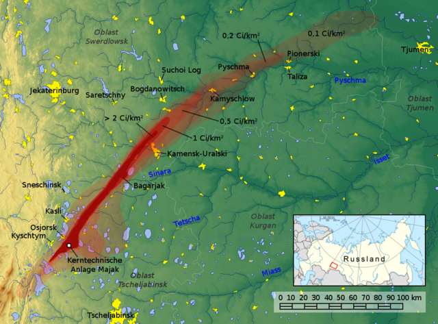
Nonfiction: Map of the East Urals Radioactive Trace (EURT): area contaminated by the Kyshtym disaster.
In the News
Fiction cross-reference
Nonfiction cross-reference
External links:
- Kyshtym disaster @ Wikipedia
Attribution:
By Jan Rieke, maps-for-free.com; Minimap: NordNordWest, Historicair, Bourrichon, Insider, Kneiphof - Own work, background image from maps-for-free.com, File:Russia conic location map.svg, CC BY-SA 3.0, https://commons.wikimedia.org/w/index.php?curid=12132519
File history
Click on a date/time to view the file as it appeared at that time.
| Date/Time | Thumbnail | Dimensions | User | Comment | |
|---|---|---|---|---|---|
| current | 15:09, 9 July 2017 | | 640 × 473 (522 KB) | Admin (talk | contribs) | Nonfiction: Map of the Kyshtym disaster == In the News == <gallery> </gallery> == Fiction cross-reference == == Nonfiction cross-reference == * Kyshtym disaster (nonfiction) External links: * [https://en.wik... |
You cannot overwrite this file.
File usage
The following 4 pages use this file: