File:Tryal Rocks detail on chart.jpg
Tryal_Rocks_detail_on_chart.jpg (715 × 383 pixels, file size: 53 KB, MIME type: image/jpeg)
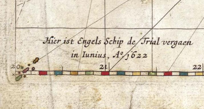
First known appearance of the Tryal Rocks on a map.
Fiction cross-reference
Nonfiction cross-reference
Detail from the bottom left corner of Hessel Gerritsz's 1627 map Caert van't Landt van d'Eendracht ("Chart of the Land of Eendracht"), showing a feature labelled Hier ist Engels schip de Trial vergaen in Iunias, A° 1622 ("Here the English ship Trial was wrecked in June 1622"). This is the first known appearance of the Tryal Rocks on a map.
Date: The original map was published in 1627.
Attribution: By Hessel Gerritsz, also written "Hessel Gerritszoon". - Cropped from the full scan, available at Image:Caert van't Landt van d'Eendracht (NLA balanced).jpg, then colour balanced., Public Domain, https://commons.wikimedia.org/w/index.php?curid=3479576
File history
Click on a date/time to view the file as it appeared at that time.
| Date/Time | Thumbnail | Dimensions | User | Comment | |
|---|---|---|---|---|---|
| current | 11:47, 10 June 2016 | | 715 × 383 (53 KB) | Admin (talk | contribs) | First known appearance of the Tryal Rocks on a map. == Fiction cross-reference == <gallery mode="traditional"> </gallery> == Nonfiction cross-reference == Detail from the bottom left corner of Hessel Gerritsz's 1627 ma... |
You cannot overwrite this file.
File usage
The following 2 pages use this file: